INDUSTRY SOLUTIONS
From topographic survey and civil engineering to utility detection, hydrographic works, geotechnical monitoring and reality capture — we match the equipment, software and support to your industry.
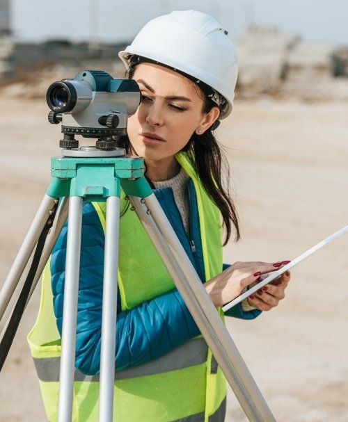
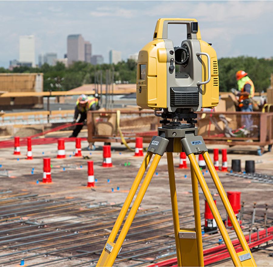
Survey Hire UK is the perfect partner for all of your geomatics survey equipment needs. In today’s fast-paced and technology-driven industry, the latest instruments are essential for achieving efficiency savings. We offer a comprehensive selection of robotic total stations, GNSS Net Rovers, and laser scanners, so you can be sure to find the perfect instrument for your topographic survey.
What’s more, our GeoMax X-PAD software allows for easy data transfer from field-to-office, giving you the flexibility to export directly into AutoCAD, SCC, N4CE, LSS, or any other survey or CAD software suite. Our software also features the latest cloud-based data sharing and collaborative surveying options, so you can easily collaborate with colleagues from any location. With Traverse Adjustments, Sets of Angles, Google Maps, Georeference Photography, and Smart Drawing Tools with customised code lists, you can trust that your survey will be as close to a finished product as possible in the field, saving you valuable time in the office.
For professional civil engineers, land surveyors, and others in the geomatics field, Survey Hire UK is the ideal choice for all your surveying equipment needs.
Survey Hire UK is the perfect partner for all of your geomatics survey equipment needs. In today's fast-paced and technology-driven industry, the latest instruments are essential for achieving efficiency savings. We offer a comprehensive selection of robotic total stations, GNSS Net Rovers, and laser scanners, so you can be sure to find the perfect instrument for your topographic survey. What's more, our GeoMax X-PAD software allows for easy data transfer from field-to-office, giving you the flexibility to export directly into AutoCAD, SCC, N4CE, LSS, or any other survey or CAD software suite. Our software also features the latest cloud-based data sharing and collaborative surveying options, so you can easily collaborate with colleagues from any location. With Traverse Adjustments, Sets of Angles, Google Maps, Georeference Photography, and Smart Drawing Tools with customised code lists, you can trust that your survey will be as close to a finished product as possible in the field, saving you valuable time in the office. For professional civil engineers, land surveyors, and others in the geomatics field, Survey Hire UK is the ideal choice for all your surveying equipment needs.
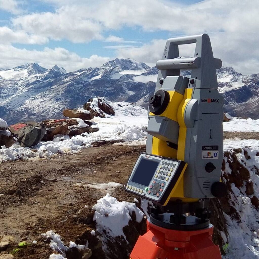
GeoMax surveying equipment has been designed to overcome the challenges that modern-day engineer faces on-site on a daily basis. With a full portfolio of engineering tools including, Lasers, Levels, Cable Avoidance Tools, GNSS and Total Stations, Survey Hire UK are able to offer a one stop solution to any Civil Engineering, Building or Construction projects in the UK. Our products are built with durability and ease of use in mind and as part of the Hexagon Group measurement quality are at the forefront of the design and manufacture of our products.
Our GNSS and Total Stations use X-PAD Software which includes onboard CAD facilities, BIM Setting Out, MEP Setting Out, Reference Line, Surface & Volumes along with many other applications to make an Engineer’s life easier and more productive.
All hires come with full technical support via TeamViewer straight into your field controller/tablet or over the telephone. We also offer on site instrument familiarity training upon request for all new hires.

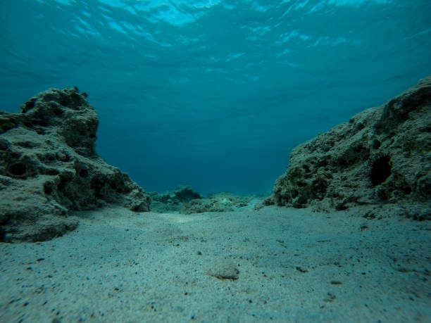
Survey Hire UK offer single beam echo sounding equipment that can be paired via Bluetooth to your own surveying equipment and attached to your boat or any water based vessel. The Ohmex Sonarmite has a range of 0.3, to 70m and an accuracy of 1-2cm. All hires come with full support and pairing and download instructions and are available to hire at short notice if required.
We also offer the Seafloor Hydrone remote controlled survey boat which can be used for all inland waterways and allows your workforce to stay safe on dry land, reducing any health and safety risks of working on the water.
The Ohmex Sonarmite and Seafloor Hydrone are the ideal tools for any land or hydrographic surveyors who require bathymetric surveys.
Survey Hire UK offer single beam echo sounding equipment that can be paired via Bluetooth to your own surveying equipment and attached to your boat or any water based vessel. The Ohmex Sonarmite has a range of 0.3, to 70m and an accuracy of 1-2cm. All hires come with full support and pairing and download instructions and are available to hire at short notice if required. We also offer the Seafloor Hydrone remote controlled survey boat which can be used for all inland waterways and allows your workforce to stay safe on dry land, reducing any health and safety risks of working on the water. The Ohmex Sonarmite and Seafloor Hydrone are the ideal tools for any land or hydrographic surveyors who require bathymetric surveys.
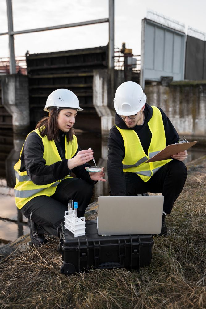
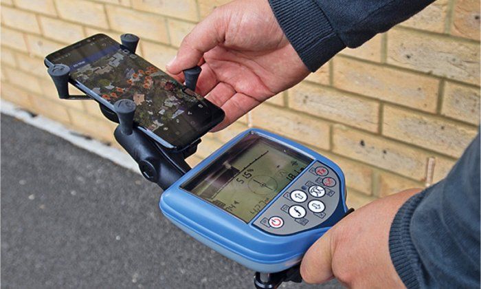
With the ever-increasing demands of detecting and mapping underground utilities, in an increasingly congested environment, Survey Hire UK have the tools and expertise to provide you with instrumentation that is accurate, easy to use and safe. With manufacturers such as Vivax, RadioDetection, Proceq, Leica and GeoMax on our hire fleet we can provide you with the latest in Cable Avoidance Tools (CAT & Genny) and Ground Penetrating Radar (GPR).
With the ever-increasing demands of detecting and mapping underground utilities, in an increasingly congested environment, Survey Hire UK have the tools and expertise to provide you with instrumentation that is accurate, easy to use and safe. With manufacturers such as Vivax, RadioDetection, Proceq, Leica and GeoMax on our hire fleet we can provide you with the latest in Cable Avoidance Tools (CAT & Genny) and Ground Penetrating Radar (GPR).
Whether surveying trial pits, archaeological features or navigating to pre-determined positions for excavation the comprehensive range of GeoMax GNSS has been a successful tool for many archaeologists. With its ease of use and features such as georeferenced photography, Google Earth data imports and exports, cloud-based data storage and easy stakeout and surveying applications this is a simple and cost-effective way of keeping an up-to-date positional record or your excavations.
Whether surveying trial pits, archaeological features or navigating to pre-determined positions for excavation the comprehensive range of GeoMax GNSS has been a successful tool for many archaeologists. With its ease of use and features such as georeferenced photography, Google Earth data imports and exports, cloud-based data storage and easy stakeout and surveying applications this is a simple and cost-effective way of keeping an up-to-date positional record or your excavations.

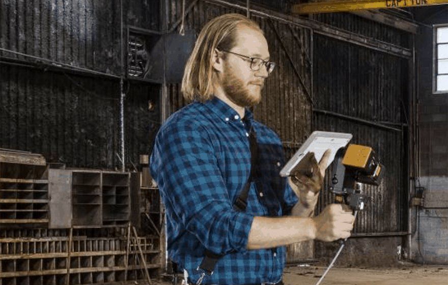
Survey Hire UK offer the latest in handheld laser scanners from GeoSLAM which provides quick and easy data capture of large areas in the shortest amount of time. The GeoSLAM Horizon has a range of 100-120m and captures 300,000 points per second whilst either being handheld, on a backpack, or mounted to a vehicle or UAV. With the inclusion of 360° Panoramic imagery and colourised point clouds data extraction GeoSLAM Connect Software is an easy and time-efficient way of capturing data.
The point cloud data from the GeoSLAM can either be converted into a variety of point cloud formats for third party software or sliced into sections and drawn into CAD formats. All hires come with a 7-day Geoslam Connect software license so there is no need for the costly ownership of the high value hardware and annual software subscriptions. Hire it when you need it.
Survey Hire UK offer the latest in handheld laser scanners from GeoSLAM which provides quick and easy data capture of large areas in the shortest amount of time. The GeoSLAM Horizon has a range of 100-120m and captures 300,000 points per second whilst either being handheld, on a backpack, or mounted to a vehicle or UAV. With the inclusion of 360° Panoramic imagery and colourised point clouds data extraction GeoSLAM Connect Software is an easy and time-efficient way of capturing data. The point cloud data from the GeoSLAM can either be converted into a variety of point cloud formats for third party software or sliced into sections and drawn into CAD formats. All hires come with a 7-day Geoslam Connect software license so there is no need for the costly ownership of the high value hardware and annual software subscriptions. Hire it when you need it.
Whether recording positions for boreholes or soil samples or navigating back to sites you have worked on previously the GeoMax Zeinth06 or Zenith16 GNSS Network Rovers are the instruments of choice for most Geotechnical Engineers. With the capability to position to cm level accuracy in challenging environments and the user-friendly interface allows non-surveyors to position assets quickly and easily. These systems can also attach geo-referenced photography and add notes and descriptions to the positional data. With easy exports into AutoCAD, Excel and Google Earth along with cloud and email-based data sharing it’s never been easier to start recording your geotechnical information out in the field.
Whether recording positions for boreholes or soil samples or navigating back to sites you have worked on previously the GeoMax Zeinth06 or Zenith16 GNSS Network Rovers are the instruments of choice for most Geotechnical Engineers. With the capability to position to cm level accuracy in challenging environments and the user-friendly interface allows non-surveyors to position assets quickly and easily. These systems can also attach geo-referenced photography and add notes and descriptions to the positional data. With easy exports into AutoCAD, Excel and Google Earth along with cloud and email-based data sharing it’s never been easier to start recording your geotechnical information out in the field.
Survey Hire UK have a wide range of GeoMax GNSS available for GIS Mapping. The X-PAD software allows positional data to be captured to cm accuracy and additional data to be assigned to those points including descriptions, materials, photographs, sketches, asset tags and as many users’ definable meta data as required. Users can import and export data using SHP files for GIS databases, AutoCAD DWG/DXF for CAD environments or Excel spreadsheets for manual data entry and archiving. Point navigation and background mapping are also features of the system including live streaming of Google/Bing Maps for orientation and urban updates. An ideal tool for any asset managers in local government, utility companies or transport industries
Survey Hire UK have a wide range of GeoMax GNSS available for GIS Mapping. The X-PAD software allows positional data to be captured to cm accuracy and additional data to be assigned to those points including descriptions, materials, photographs, sketches, asset tags and as many users' definable meta data as required. Users can import and export data using SHP files for GIS databases, AutoCAD DWG/DXF for CAD environments or Excel spreadsheets for manual data entry and archiving. Point navigation and background mapping are also features of the system including live streaming of Google/Bing Maps for orientation and urban updates. An ideal tool for any asset managers in local government, utility companies or transport industries
Hand-picked manufacturers across surveying, monitoring, utility detection and bathymetry — all available to hire with expert support.
 GeoMax
Our comprehensive GeoMax surveying hire fleet offers a selection of the highest quality total stations, GNSS, lasers, and levels available. Our professional team has the expertise to help you choose the right surveying equipment for your project, ensuring the best possible results.
Featured Products
 GeoSLAM
GeoSLAM LiDAR mobile mapping systems provide the ultimate mapping solution for any indoor, outdoor or underground environment. Our professional-grade solution gives you the ability to walk through any environment and build a digital map as you go, providing you with a highly efficient way of capturing detailed 3D images, enabling you to build an accurate, digital representation of any area in no time.
Featured Products
 Move Solutions
Move Solutions IoT monitors to help you keep your structural health in check. Our professional-grade monitors give you the peace of mind that your structures are stable and secure. With our cutting-edge technology, you can rest assured that your structures are being monitored and maintained in an efficient and reliable manner.
 Sea Floor
Seafloor is a leading bathymetric instrumentation specialist in the USA, and Survey Hire UK is offering chartered surveyors and civil engineers the opportunity to hire the Hydrone Remote Controlled Boat. This powerful vessel is ideal for any inland waterways including lakes, rivers, reservoirs and canals, and comes with the Ohmex Sonarmite single beam echo sounder – providing accurate readings to within 1 to 2cm, at depths of up to 70m. Its position can be accurately tracked using Total Station or GNSS equipment. Our specialist team are on hand to provide training and guidance if required.
 Vivax
Vivax
Vivax-Metrotech is a trusted provider of innovative solutions for the surveying and engineering industry. We provide advanced solutions for surveying buried utilities, locating and mapping of fiber-optic cables, detecting ferrous metals and performing ACVG surveys on cathodic protected pipes. Our products are also ideal for finding sheath to ground faults on cables, inspecting the interior of pipes and ducts, and mapping of buried utilities. With our cutting-edge products, chartered surveyors and Civil Engineers can enhance their accuracy and efficiency in a variety of surveying and engineering tasks. We take pride in delivering the highest quality products and services to meet customers' professional needs.
 Radiodetection
Radiodetection is the global leader in critical infrastructure and utilities management, providing chartered surveyors and civil engineers with the most advanced equipment and solutions to prevent damage, manage assets and protect lives. Founded in 1977, Radiodetection is renowned for its comprehensive range of tools and digital solutions. Our brands – Schonstedt, Sensors & Software and Dielectric – offer a wide selection of solutions tailored to your professional needs. With Radiodetection, you can rest assured that your infrastructure and utilities will be managed safely and efficiently.
Our specialists will recommend the right combination of hardware, software and support — and arrange a free on-site or remote demo.